
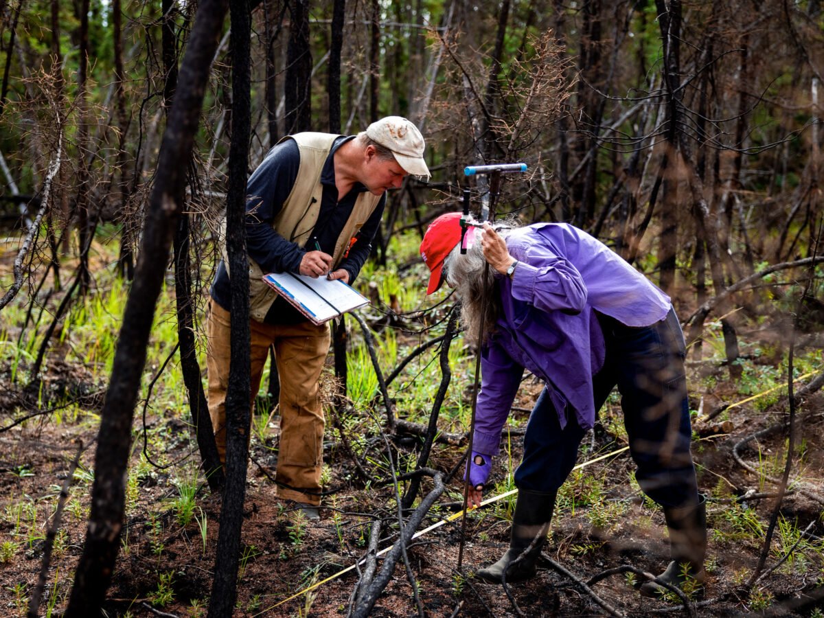
In the middle of an especially warm July in 2021, a wildfire ignited in a thick forest of black spruce and peeling paper birch trees on the northern campus of the University of Alaska, Fairbanks. The blaze, possibly sparked by lightning, burned across the dry carpet of feather mosses and lichen before climbing into the crowns. By the time fire agencies responded, flames had reached 12 feet in length and sent up a 500-foot column of smoke. A few days shy of the five-year anniversary of the Yankovich Road Fire, I followed three members of the Alaska Fire Science Consortium into the boreal forest, walking along cross-country ski trails lined by feathery field horsetail. In 2024, the organization, which hosts presentations to keep wildfire managers abreast of new developments in fire science, helped turn the area into an educational walking trail, with interpretive signs posted along the route. About a half-mile in, the horizon opened up as we reached a sparse stand of naked, blackened tree trunks, stripped of needles and neighbors. Hilary Shook, the coordinator of the consortium, stepped off the trail with her thaw probe, a T-shaped pointed metal rod used to detect the upper boundary of the permafrost, the ancient layer of frozen soil that underlies 15% of the land around the Northern Hemisphere and stores roughly twice as much carbon as the atmosphere. A test of the ground just outside the burn scar hit the concrete-like layer about a foot below the surface. But as Shook applied pressure here, where the fire had burned away the moss and organic-rich topsoil that insulates the permafrost, the probe plunged at least three times deeper into the ground. “That was an immediate effect of the fire,” said Alison York, the outgoing coordinator of the organization, who was standing nearby. “When we monitored right after, it had already thawed quite a bit.” Researchers Eric Miller (left) and Alison York (right) record thaw depth at the site of the Yankovich Road Fire. LEIF VAN CISE
This rudimentary tool, offering a measure of depth from a single point in the earth, reveals an escalating problem across the far north. As climate change fuels increasingly frequent and severe fires in the planet’s northern latitudes, they’re accelerating the thawing of more and more permafrost. This allows the organic matter to break down and release powerful greenhouse gases that contribute to a spiraling climate feedback effect, propelling more warming, more fires, and the loss of still more permafrost. Most dramatically, intensifying wildfires in Canada released more carbon than the nation’s combined fossil fuel emissions in 2023. As in Alaska, many of these megafires occur in vast remote areas where the policy is to let them burn so long as they don’t threaten human habitats. Yet if intensifying fires and warming are left unchecked, the world’s boreal forests and permafrost could increasingly transition from giant carbon sinks into massive sources of atmospheric carbon. Now, international teams of researchers across the US, Canada, and elsewhere are scrambling to understand what’s at stake, financially as well as ecologically. They’re looking at preventive measures, like controlled burns, and studying the potential to rapidly detect and extinguish wildfires before they grow out of control. They’re even exploring what was once unthinkable: sending in human firefighters not to save lives or structures, but to protect one of our planet’s great stores of carbon. “We need to figure out a better way to live with wildfire,” says Brendan Rogers, a senior scientist at the Woodwell Climate Research Center, one of the main organizations driving the loosely collaborative research effort. “I do think that it can make a meaningful difference.” Woodwell scientist Brendan Rogers (above) has been studying the impact of Arctic-boreal fires on permafrost, as well as what could be done about it. PHILIP KEITH (PHOTOS), WOODWELL CLIMATE RESEARCH (MAPS)
Woodwell, the University of Victoria’s Polis Institute for Ecological Governance, and the nonprofit Alaska Venture Fund are now partnering on a multimillion-dollar initiative known as North Fire to study and raise public awareness about the potential benefits of these interventions, MIT Technology Review can report. The idea is complicated and controversial for a number of reasons. Wildfire is a natural and necessary component of healthy forest ecosystems. Preventing or suppressing fires across huge stretches of largely unmanaged Arctic-boreal forests and tundra would take vast resources. And it’s not yet clear how much of a difference such interventions would make in emissions. Ultimately, the mere fact that researchers are considering such extreme interventions into natural systems is a grim reflection of the dangers we’ve placed ourselves in by continuing to generate more and more greenhouse-gas emissions each year. Those threats are forcing us to grapple with increasingly difficult questions that involve ever steeper trade-offs: What’s the best way to spend our finite resources and dwindling time to avoid the worst dangers of climate change? And when, if ever, is it okay to put people in possible danger to reduce broader risks to the world? ‘A massive blind spot’
Emissions from forest fires have risen 60% around the world since 2001—but they’ve nearly tripled across the boreal forests in the far north. This stretch of the globe is warming as much as four times faster than the rest of the planet, drying out the landscape. In addition, lightning strikes that set off fires have ticked up sharply as warmer air increases the convective energy in the atmosphere, driving the updrafts that trigger thunderstorms. In that sense, humans have already interceded in these otherwise natural ecosystems by producing the greenhouse-gas emissions that are increasing temperatures, subjecting forests to fire patterns well outside healthy historic norms. “To me, that outweighs the existential dread of ‘Should we or should we not intervene?” says Kate Hayes, an assistant professor at Western Washington University, who is working with Woodwell to study the emissions benefits of fire interventions. “We’ve already intervened, arguably. And so from here, it’s a little bit of a Band-Aid on a bullet wound.” The permafrost that encircles the northern latitudes, underlying large stretches of Canada, Greenland, Siberia, Scandinavia, and other Arctic nations, stores around 1. 5 trillion tons of carbon, much of which froze in place millennia ago. The steady global rise in temperature, however, has already shrunk the footprint of Arctic permafrost by about 12 % since 1850, with that loss rapidly accelerating during the last 50 years. By 2100, fire-driven thawing of permafrost could release about the equivalent of nearly 80 billion tons of carbon dioxide, under high warming scenarios. That’s more than half the emissions that fires will release from the direct combustion of vegetation, according to a January study . And it would be on top of more than 400 billion additional tons that could be released through thawing from general warming over that period. Despite its growing contributions to climate change, only a minority of the models that have informed the UN’s major climate reports to date include the gradual loss of permafrost through warming temperatures, and none incorporate the abrupt collapse and accelerated thaw that can often occur after fires and heat waves. In light of those phenomena and other powerful and undercounted climate feedback effects, we’re almost certainly underestimating how rapidly the planet will warm up, as scientists warned in a paper earlier this year. These warming-driven emissions are a “massive blind spot,” says Brian Buma, a senior climate scientist at the Environmental Defense Fund and a coauthor of the paper, who is working to develop tools that could help fire agencies decide which fires to prioritize. As escalating fire and permafrost emissions become significant additional contributors to climate change, some researchers have begun to explore what it might cost to take on the responsibility of preventing them, in much the way we’ve sought to cut the pollution from power plants, vehicles, and factories. A 2022 paper in Science Advances , led by researchers at Woodwell and the Union of Concerned Scientists, found that making greater efforts to put out boreal fires could be a cost-effective climate solution—comparable to, or even cheaper than, addressing emissions by building wind turbines, solar farms, or carbon-sucking factories. The Yukon Flats pilot
Those economic findings were instrumental in getting more researchers to take the idea of tackling fire emissions seriously, says Peter Frumhoff, a coauthor of the 2022 paper and now a senior science policy advisor at Woodwell. For several years now, Woodwell researchers have been in discussions with forest managers, fire agencies, Indigenous communities, and other groups across Alaska to communicate the potential of this approach. It hasn’t been an easy sell, given the constrained resources and tightly defined mission of the federal and state agencies responsible for combating fires in Alaska. The general policy there is to allow fires in remote territories to burn unless they present a direct danger to communities. “Those agencies are tasked with protecting life and property now, and to a lesser extent natural resources,” says Randi Jandt, a fire ecologist at the Alaska Fire Science Consortium. “But they’re not tasked to save the world.” There was one notable early success, however. The Yukon Flats National Wildlife Refuge is an 11-million-acre patchwork of wetlands, forests, and bogs. The foothills sit above a particular type of frozen soil known as yedoma. It’s an especially deep, ice-rich, and carbon-dense form of permafrost, composed of massive wedges of silty, wind-blown sediments frozen during the late Pleistocene, which ended about 11,700 years ago. (It also presented ideal conditions for preserving mummified remains of woolly mammoths.) “It took kind of the last ice age to accumulate,” Hayes says. “So there’s no rapid way to re-accumulate it. We can’t really put it back.” LEIF VAN CISE
LEIF VAN CISE
LEIF VAN CISE
Members of the Alaska Fire Science Consortium hike into areas affected by fire to measure the layers of ash left in the soil on the forest floor. In 2019, the region suffered a series of devastating fires that burned some 750,000 acres . After an Alaska Fire Science Consortium meeting at which Woodwell scientists highlighted the possible climate benefits of more aggressive fire suppression, the refuge’s then manager, Jimmy Fox, began exploring the possibility of putting out blazes when they threatened that permafrost, whether or not they threatened human habitations. The early reaction was not encouraging. “You’re going to have people jumping out of airplanes with parachutes to save frozen woolly mammoths—and maybe dying from that?” he recalls being asked. But eventually, he persuaded managers at the US Bureau of Land Management’s Alaska Fire Service to carry out a pilot project on a 1. 6-million-acre section of the Yukon Flats. They agreed to try to put out fires there if they had the resources available and believed they could contain a blaze within 72 hours. Woodwell and its partners agreed to study how that change affected permafrost loss and fire emissions, in the hope of making the case for similar programs elsewhere. It wasn’t clear the pilot program would survive after Donald Trump was reelected, particularly once the DOGE initiative retroactively cut the public funding for that research collaboration. But in February, the federal government formally preserved the program and broadened its rationale to include goals like protecting habitat diversity, water quality, and air quality. Mapping and modeling
One of Woodwell’s main tasks now is determining when and where fire agencies should step in. Crucially, excessive efforts to stamp out fires in the past have allowed the buildup of dry plant material that fuels more severe fires later. “We’re not going after all fires all the time,” says Rogers over lunch in a sunny courtyard on the Stanford University campus, where Woodwell and EDF hosted a workshop on potential fire interventions in January. “We can’t do that. We don’t want to do that. We shouldn’t do that. So how do we prioritize our resources?” Woodwell and its collaborators are working to answer that question by developing a map of burn risk and carbon vulnerability across interior Alaska. The plan is to eventually expand it across much of Canada as well. These maps will highlight the locations of rich reserves of yedoma and other forms of permafrost, forecast where fires are most likely to break out in the next 10 to 15 years, and predict how they’re likely to behave and spread. “Our ultimate goal is to get a layer that can tell us, if a fire were to occur, what areas are most vulnerable to high carbon emissions, permafrost thaw, permafrost degradation,” Rogers says. In response to a question about potentially putting firefighters at risk, Rogers stressed in an email that it’s “a very serious issue that needs careful consideration.” He added that early fire detection technologies, preventative fire stewardship practices, improved fire suppression planning and other measures can all help to reduce dangers to firefighters as well as communities…